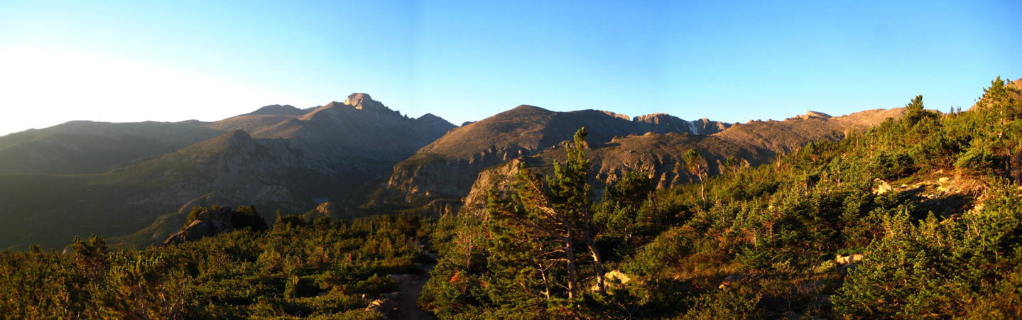
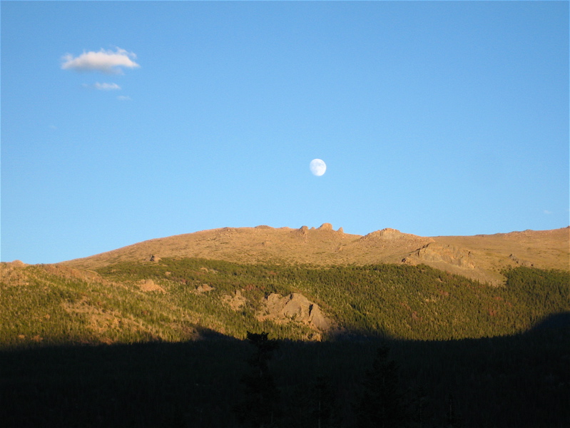
 Sunrise over mountains never gets old. |
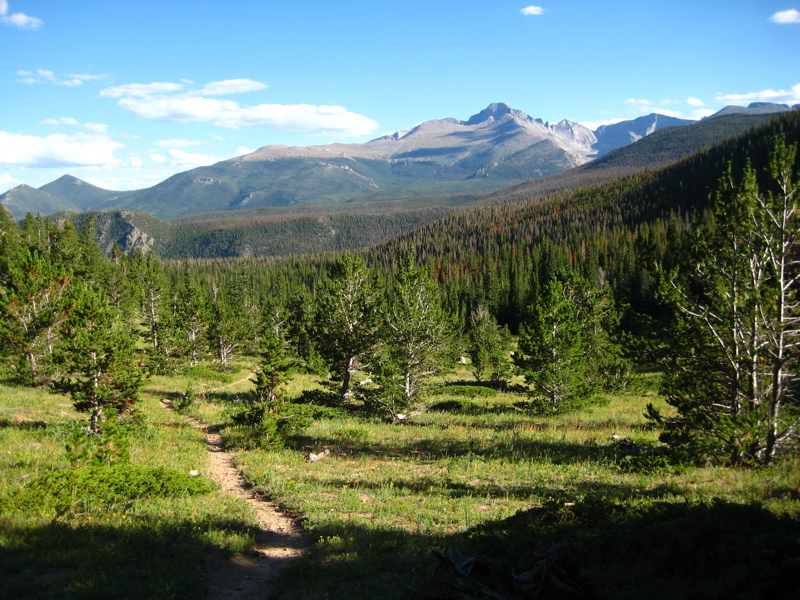
In theory, it would work thusly: climb the Flattop trail from Bear Lake to the Divide. Strike off across the summits of (at least) five additional mountains before connecting to the trail that runs from Milner Pass to Trail Ridge across the top of the huge, trackless Forest Canyon. Continue the circuit by coming down the long ramp of Trail Ridge, zig-zagging across the paved road, before striking out across Tombstone Ridge and down the steep Ute Trail to Moraine Park. From there, I would have my pick of trails back to Bear Lake or, in the event the previous 30+ miles had tired me out, catch the free hiker shuttle back up to Bear. No problem!
Clearly good weather was crucial to my plans and the forecast looked flawless for Saturday. Clearly having as much time as possible to complete the loop was also crucial, so I set out Friday night for my double-secret bivy spot up in the park so I could get an early start on Saturday morning. A gorgeous night under the stars at 9000' also did wonders for my attitude, despite only netting about four hours of sleep.
Sunrise over mountains never gets old. |
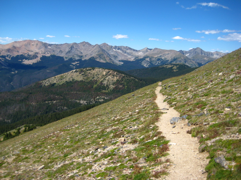
By 5:30, I was at Bear Lake, watching the growing light of what appeared to be a made-to-order day and putting the final touches on my mountain running gear. Gear for something like this is a delicate balance between preparedness and encumbrance that I've been working on all summer. I wondered how my racing friends were handling the pre-start butterflies and gear issues of their own. At 5:45 it was just light enough not to need a headlamp and I trotted around Bear Lake and started up the familiar trail toward Flattop. Despite many early-morning trips up this trail, it never gets old! Sunrise to the sweltering east paints the summits a brilliant orange/gold which contrasts beautifully with the deep evergreen of the stunted trees. I hiked along (many miles to go) and noted the moments of both the 6am Leadville start (except that it actually started at 4 am! Oops!) and the 7am Pikes Peak Ascent start and sent good vibes to my various friends starting out on their own epic endeavors.
From the summit of Flattop, I turned north and ran a mile of the wonderful Tonahutu Trail before scrambling up the short rock pile that is Ptarmigan Point. It was still remarkably windy and cold up on the Divide, so I slathered on some sunscreen, but kept my long sleeves, hat and gloves out. Bighorn Flats stretched for miles ahead, but I could make out the rising humps of the rest of the day's objectives on the other side. A bee-line for Sprague Pass would have gotten me there quicker, but I was feeling good and stuck close to the edge of the Flats to have a look around. In doing so, I got some amazing views of Notchtop and Odessa Gorge down below, and also scared up a group of bighorn sheep moms and babies grazing on the tundra.
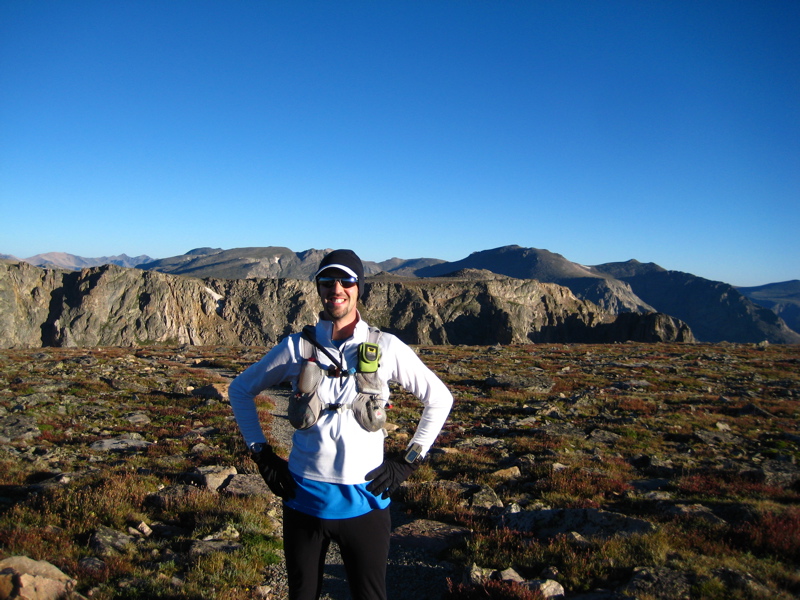 Into the unknown! |
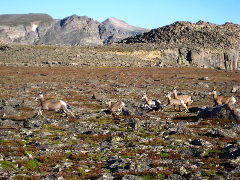 A group of moms and lambs on Bighorn Flats. |
Knobtop was another tower of jumbled blocks sticking up from the otherwise flat Flats, but the descent from there to Sprague Pass was remarkably rough. There was a significant downhill slope, but, after three nearly-rolled ankles in as many minutes, I slowed to a walk instead of trying for time. You're by yourself, there's no trail, and no one is going to bail you out. Getting hurt would be a bad, bad thing.
 Looking back on the climb up from Sprague Pass. |
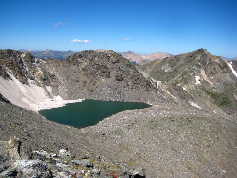
There was no running/walking question as soon as I got to Sprague Pass. The slope climbs a thousand feet in a mile and I trudged up doggedly into the unknown. Fortunately, spectacular views down into the Sprague Glacier cirque kept me motivated. The basin held four beautiful lakes which must be very challenging to get to. These would be the first of very many such lakes I'd see (from above) today.
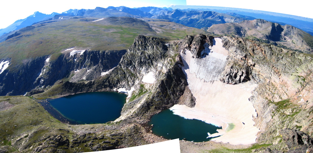 The spectacular Sprague Glacier, Lake Irene, and Rainbow Lake. |
The summit of Sprague itself is a broad, tundra plateau, but a pair of pointed cones marked a distinct sub-summit off to the east on the ridge toward the massive Terra Tomah Mountain. I scrambled up these cones and took in the spectacular view of the Sprague Glacier cirque I'd just passed, and, in the other direction, the wild, remote Hayden Gorge.
 Looking north at Hayden Gorge from Sprague Peak |
There followed several wonderful hours of tundra-hopping picking my way along the precipitous edge of the Divide passing one embayment after another, each with stunning views of a pristine alpine lake or three, a gnarly tallus slope, the remnants of a snowfield, or some wild combination of all three. Each valley dropped gradually or quickly down below tree-line and merged with the huge wilderness of Forest Canyon. There were no aid stations, mile markers, or spectators. I was alone, at altitude, in full exploration mode and enjoying myself immensely. Sprague, Hayden Spire (at 5.6, a project for another day), "Mt. Eleanor", Pt. 12,497, Cracktop, Cheif Cheley...
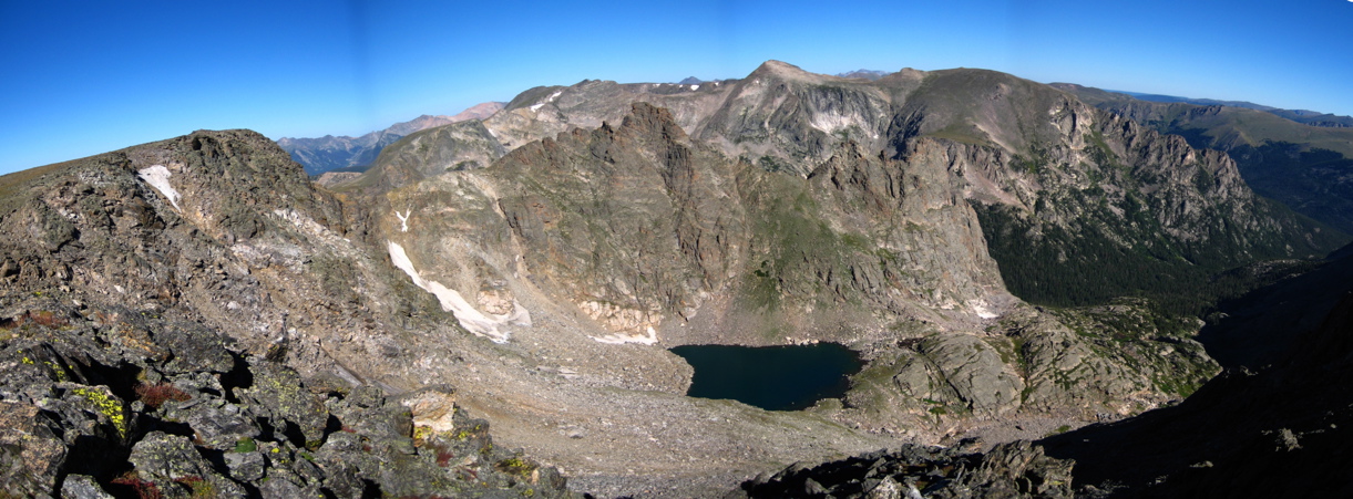
Even this alpine bliss was starting to wear thin as I sat on the summit of Cracktop gazing into the next canyon to the north, repleate with several large, remote lakes. I could see Mt. Ida, the end of difficulties across the cirque and I could see tiny figures moving around up there. I trudged over the gnarly felsenmere ridge, dropped briefly into a saddle and climbed the chossy, sharp Cheif Cheley Peak. The people were still there on top of Ida. Then there was an unreasonably long drop into a saddle and a final, ludicrously-steep climb (400' in 0.15 miles), to the final summit.
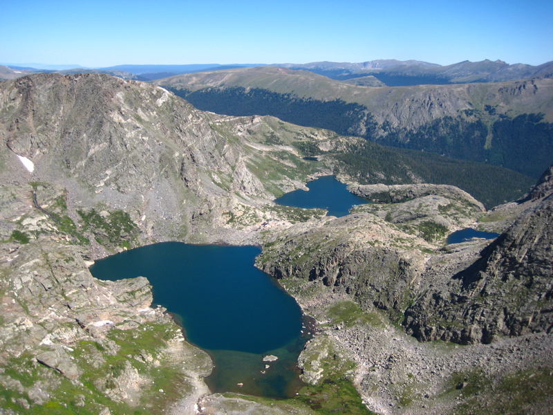 The impressive Auzure and Arrowhead Lakes from Cracktop. |
 Highest Lake nestled under the ornery Cheif Cheley Peak (center) with the long-sought Mt. Ida beyond (right). |
It was great to chat with people again. We sat, enjoyed some lunch, enjoyed the scenery and discussed the finer points of Mt. Ida (of which there are many). But I had miles to go before I slept and reluctantly set out in search of easier terrain and, if rumors were to be believed, an actual trail!
 After five hours off-trail, the run down toward Milner Pass was really great! |
Eventually, I connected to the Ute Trail running from Milner Pass to the Alpine Visitors Center, paralleling Trail Ridge Road. This was a popular, well-trodden route and I made decent time across the scenic top end of Forest Canyon past numerous small ponds.
It was somewhat shocking to arrive at the Alpine Visitors Center featuring bus-loads of tourists, souvenirs, and the whole nine yards. "I made it to the top!" proclaimed a common t-shirt... "Did you really?" I mentally added. It was 2pm and I was a couple hours behind schedule, but the class 2 terrain on the Divide had taken me a lot longer than I'd expected. Schedule or no, I sat for a few minutes to eat some food, drink a Coke, and reorganize my pack for the long downhill cruise to Moraine Park.
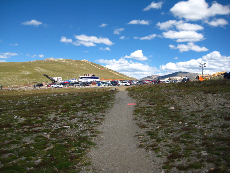 The Alpine Visitor' Center came as quite a shock after 20 miles alone. |
 Hayden Gorge from Trail Ridge. Looks very far away. |
My plan of running the crest of Trail Ridge, crossing the pavement when necessary, didn't last long. After 20+ miles of rough trails and lack-of-trails, I was more than ready to take a faster if less aesthetic route and thus logged half a dozen miles running down the narrow shoulder of Trail Ridge Road itself. The grade wasn't too extreme and I found it surprisingly runable. I cut a few switchbacks, but generally stuck to the pavement doing sub-9-minute miles much of the way.
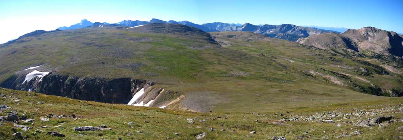
I was definitely feeling a little haggard at this point, but I hadn't had any major bonks yet, and I was generally managing pacing, nutrition, and hydration pretty well. Nevertheless, I slowed to a walking pace as soon as I left the pavement for the rocky Ute Trail across Tombstone Ridge. From Trail Ridge, I'd gotten views west of the Divide I'd traversed hours earlier and it was mighty satisfying. Now I got a good view of Flattop where I'd started my big day what-felt-like weeks ago. It seemed pretty far away as I started the descent of Windy Gulch via the Ute Trail.
 The Ute Trail drops precipitously off the end of Tombstone Ridge. |
 Finish strong! The Ute Trail becomes runnable again at the bottom of Windy Gulch. |
The less said of Windy Gulch, the better. It was very steep, very rough, and, while there were a dozen people or more hiking around on the tundra above, it's clear not many ever venture down this trail. Couple this terrain with my biggest bonk of the day and I was not a happy camper. However, all things must come to an end; I started to feel much better just about the time the angle eased to a gentle descent. Much of the final five mile cruise through the dusty trails above Moraine Park were pretty quick and surprisingly fun, despite the 30 miles I'd already piled on. Maybe something about the thick air? Nevertheless, I was more than ready to be done when I stumbled into the Moraine Park Campground and started pounding pavement amidst tents and RVs, looking for the exit and rumored bus stop.
"Rumor has it that there's a shuttle bus that stops here," I said to a group of park rangers near the campground entrance station.
"The rumors are correct," they said. "Where do you need to go?"
"Bear Lake"
"Well, this will be about the last shuttle to Bear Lake, so you won't get to spend any time there."
"Oh, it's okay, I'm parked up there," I said.
I could see the gears turning. "So... then how did you get down here?!" I explained. "Wow! That's a heckuva run!"
| And they were right; the next-to-last shuttle arrived about five minutes later and I spent a very nice hour lounging on a soft seat while the shuttle bus made lots of stops, picking up hikers, chatting with the drivers, and enjoying not moving under my own power. And they were right again; it was a heckuva run. 36-ish miles in twelve and a half hours. Five thousand feet of gain and six thousand of loss over eight named summits and three unnamed summits, all but one of them new terrain for me. Even if the distance was a good deal short of 50 miles, the time-on-feet factor (which may be more important) was similar and I felt reasonably good for most of the day, considering. No doubt, I was ready to stop now, but fifty miles on better course with the good company of fellow racers and aid stations to keep me motivated seems not so far-fetched at this point. |
 Coming full-circle after a very long day in the mountains. |
 Adventure Library |  Neithernor |